|
|

The Walk: This one section replaces two sections of the full circular walk. Good walking surface, but trackless, steep grassland and rough tracks on the (optional) detours.
Distance: 3.6 km (4.3 km with two detours to Greystanes Hill and Prospect Lookout)
Time: 40 minutes (1 hr 05 min with detours)
Getting there: Westbus routes 811, 813 and 815 run from Parramatta and Merrylands to Pemulwuy Marketplace. Route 830 runs along Greystanes Road from Cabramatta and Blacktown and also passes near to the end of this walk at Prospect Hotel. However this last service is very infrequent on weekends and public holidays.
Car parking: in Driftway Drive near the start or in the car park of Pemulwuy Marketplace.
This section of the Circular Walk starts at the roundabout where Butu Wargun Drive meets Driftway Drive. This is the hub of the new suburb of Pemulwuy. Look at the noticeboard by the roundabout and check that the ridge line green area is still labelled "Marrong Reserve - Walkway and Lookouts." This is your assurance that public access to the highest point of Prospect Hill is welcomed. Although people have been wandering over this area for at least 40,000 years, Delfin (the developer) and Holroyd Council have not made access easy.
|
|
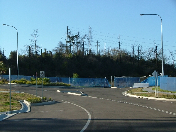
Start the walk by crossing the bridge over Girraween Creek and walking up the steeper part of Butu Wargun Drive. This road has remained closed to traffic since it was made a few of years ago. Since the "temporary" closure of the Lower Prospect Canal Reserve walkway however, it has been open as a walkway/cycleway.
After a few minutes you will come to a roundabout. Now look for an entrance to the Marrong Reserve on your left. The most likely place is here just by the roundabout. In spite of the description of this area as a recreational area in numerous documents (See quotation), the Council has not made any clear provision for access. At best the possibilities are intermittent. See our Access page. If you are unable to find a way in, you will have to miss Prospect Hill's highest viewpoint and continue the walk here.
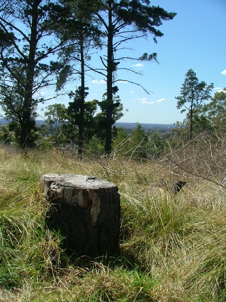
If you are able to enter the Marrong Reserve, then a faint 4x4 track leads half-right towards the crest of the ridge, then curves round left alongside the fence which follows the crest as it rises to a level section at the top. It's difficult to decide when you have arrived at the exact highest point, but I reckon it's where there is a noticeable pine stump. There is a "goodly prospect" westward to the Blue Mountains (1). Prospect Reservoir is hidden by the western ridge of Prospect Hill, on the summit of which you can see the two water towers.
At this point the view eastwards is obscured by nearby pine trees, but if you move a few metres further along you will see the high rise buildings of Sydney's CBD. The thin stalk of Sydney Tower is unmistakable and, further to the left, the arch of Sydney Harbour Bridge can also be seen. A little to the right of Sydney Tower, and still in front of the CBD buildings you can also make out the arch of the main stadium at Olympic Park.
To the south you can see the South Summit of Prospect Hill and to its right the Gap (through which the industrial sheds of Wetherill Park are visible). Looking further right is Reservoir Hill, the impressive cliffs of the west wall of the quarry, and finally Water Tower Hill. At ground level, this hill is just a metre lower than where you are standing. Keen eyes will pick out a trig. station on top of the older, left-hand water tower.
|
|
Plans are afoot to create a proper walkway which will wind its way along the ridge you are standing on, both southwards towards the South Summit and northwards to Prospect Lookout. It will be a board walk with lookout points, interpretation panels and seats. I hope the bush atmosphere will be preserved also.
Now retrace your steps down to Butu Wargun Drive. As you descend the last bit of steep grass, stop to view the summit ahead of you, Prospect Lookout, which you are about to tackle.
This is the second detour. You will return to this point. On the opposite side of Butu Wargun Drive, again by the roundabout, there is the entrance to an area of rough ground. Locate a narrow path which crosses some piles of loose dirt, then some older, more compacted quarry waste before dropping steeply for a couple of metres to the quarry floor. You will now be faced with the rock wall of an old quarry. The path circumvents this round its right-hand edge and then takes you leftwards along the top of the quarry face.
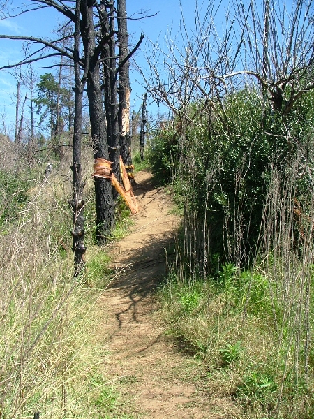 |
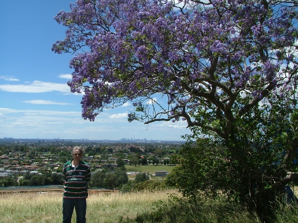
Take care with your footing here as the path slopes sideways towards the drop. A moment later the path turns right and you can walk through an open gate on to the summit of Prospect Lookout, which is graced by a jacaranda tree and an old eucalyptus of undetermined species. The highest point is probably by the fence about equidistant between the two trees. Watch out for some old barbed wire lying in the grass by the eucalyptus.
Here it's the views to the east and north which are spectacular. Eastwards there is now an unobstructed view over Sydney. To the north-west the tall, square building with four flags is Blacktown Workers' Club with the Blacktown Council Building just to its right. The northern horizon lacks features but is distant nonetheless. Nearby, from north to east there was grassland right down to the creek until November 2008 when building started on the latest housing development area, which is now (October 2009) creeping well up the hillside. It's a pity - because this area has been used for agriculture since the first land grants to thirteen time-expired convicts in 1791 (See the Settlement page), and for hunting and gathering for thousands of years before that (See the History before 1788 page). Most recently it was used by the Commonwealth Scientific and Industrial Research Organisation (CSIRO) from 1946 until about 2001 for research into animal breeding and husbandry. (See the Prospect Lookout page).
|
|
Go back through the pair of open gates and turn left and then left again, retracing your steps along narrow path along the edge of the old quarry face below you on your right. The path then turns right and you will see the rock wall of the quarry. The path crosses some overgrown hillocks of quarry waste before reaching a narrow gate in the boundary fence. Pass through into Butu Wargun Drive by the roundabout.
Turn right at the roundabout and walk over the summit of Butu Wargun Drive as it passes through the ridge. Follow the road down to its junction with Reconciliation Road. Now turn left (you can pass the Mine Entrance notice as the actual entrance is further along the road). Walk for less than five minutes until you see a place made for walkers and cyclists to cross the road.
At this point you may like to follow Short Cut B along Reconciliation Road, and so approximately halve the length of the Circular walk and return to Hyland Road or Pemulwuy.
Continuation
To continue this walk section to Andrew Campbell Reserve, cross over the road with care and continue along the opposite side until you see a footpath on the right. Stop to look at inside of Prospect Hill, which is now (January 2010) a vast flat landscape ready for the building of a huge complex of sheds - warehouses, factories, call centres, etc. It is surrounded by the walls of the recently worked out Prospect Quarry, which have now been made safe by various stabilisation techniques. Now follow the footpath to its far end, which is the end of Picrite Close. On your left you will see Water Tower Hill, tantalisingly close but inaccessible as yet.
Follow Picrite Close to its end at Reservoir Road, noticing the avenue of hooped pines across the meadow on your left. Here turn left and then left again into William Lawson Drive. You will then be in the precinct of Prospect Reservoir.
At the gate, pass round the end of the post-and-wire fence on the right for a more pleasant and safer walk along the grass verge. On the right you will pass a row of paddocks where kangaroos may sometimes be seen. Behind the paddocks is a large area of bushland, described as,
... one of the finest examples of the native bushland left in the western suburbs of Sydney... It is classified as Cumberland Plain Woodland... In the protected catchment [of Prospect Reservoir, the] degrading influences are largely absent and this is reflected in the excellent bushland condition. (Heritage, Prospect Reservoir and surrounding area).
The fine avenue of hooped pines, Araucaria cunninghamii that you are walking down was planted in connection with the construction of Prospect Reservoir in the 1880s. It leads to the site of Veteran Hall the home of early settler William Lawson. Walk past the entrance of Pecky's Playground and almost at once you will arive at the Andrew Campbell Reserve on the right.
This is end of the Shortcut Section of the Circular Walk.
Next Section of the Circular Walk
(1) Local lore says that the phrase "a goodly prospect" was quoted by Governor Phillip, thus giving rise to the name Prospect Hill. I can find no authority for this. The phrase is from John Milton's Paradise Lost of 1667 (Milton 1667, Book 3): "... Obtains the brow of some high-climbing Hill,/ Which to his eye discovers unaware/ The goodly prospect of some forein land/ First seen, or some renownd Metropolis/ With glistering spires and pinnacles adornd..." I have argued elsewhere in this web site that it is more likely that Watkin Tench was the one who named Prospect Hill. He was the first to record an ascent of the hill and his detailed knowledge of Paradise Lost is a matter of historical record. Indeed he used several quotations from it (though not the one quoted above) in his description of his ascent of Prospect Hill. (« Back)