The northernmost top
This northernmost summit of Prospect Hill lies about 400m north of the highest summit, Greystanes Hill. It was apparently called Prospect Lookout in the 1920s and a picnic site was made here (Holroyd 2005, p 68). In the absence of any other accepted name, I have kept to this one.
Perversely it has been referred to as Prospect Hill in some recent documents (Holroyd 2007, pages 1-1, 1-9 and 3-23 and the map (Figure 1-3) on page 1-7). I suggest that, to avoid confusion, the name Prospect Hill should be used only for the whole ridge. The Lookout is definitely lower than both the nearby Greystanes Hill and the more distant Water Tower Hill.
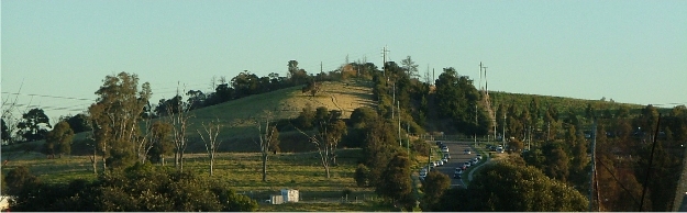
Prospect Lookout from the North, taken near the junction of Blacktown Road and the Great Western Highway.
|
|
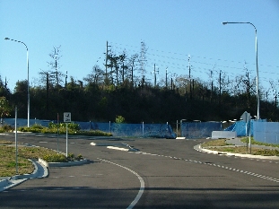
It is reported that Prospect Lookout has a height of 112 metres above sea level (Holroyd 2005). It is the northernmost summit of the whole Prospect Hill ridge. The ridge between it and the next summit, Greystanes Hill, has been cut through by a quarry road which has recently been fully modernised as Butu Wargun Drive. The ridge from this cut to the summit of the Lookout is a confused, scrubby area containing several small disused quarry faces.
A fence and a line of willow trees descends in a straight line to the east of the summit almost to Greystanes Creek. A further fence descends northwards towards to M4 Motorway. In the ninety-degree arc between these two boundaries, the slope descends as rough grassland towards Greystanes Creek. The lower part is now (since November 2008) being developed as part of the new Lakeside Housing Development. The whole hillside contained some of original 1791 grants to emancipated convicts. The land here was used for agriculture, originally including arable farming but later mainly grazing, from that time onwards until 1946 when it was acquired by the Commonwealth Scientific and Industrial Research Organisation (CSIRO) for its animal husbandry research. Part way down is a low rock wall believed to be an early quarry used by the settlers as a source of building stone.
|
|
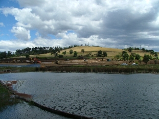
The two fences referred to above, running respectively east and north from Prospect Lookout, correspond to some of the boundaries of the land grants to emancipated convicts in 1791. They have been preserved because they became the boundaries of the lands occupied by the CSIRO. The 30-acre block nearest to the Lookout summit was originally granted to George Lisk. This extended northwards to a point just below the small quarry. Here it adjoined the 50 acres granted to William Butler which extended as far as the present gates of the industrial area which includes the large Australia Post building. Beyond this was a 30-acre block granted to John Nichols which is now crossed by the M4 Motorway and the Great Western Highway. Nichols was one of the most successful of the 1791 grantees (Nichols).
To the south of Lisk's grant, across the strongly wooded boundary, is an untidy area which was the 60-acre grant of William Parish extending across where Butu Wargun Drive now lies. All these grants extended eastwards away from the summit of Prospect Lookout to the marshy margin of Greystanes Creek.
|
|
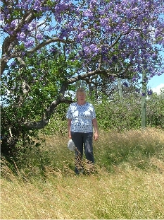
Immediately to the west of Lisk's grant, a sandy gully descends northwards between rock walls from the summit to the end of Clunies Ross Road. The remains of an avenue of trees lines the gully, extending the line of the road. This is one of the driftways created at the time of the 1791 land grants and shown on the earliest maps of the area.
The western side of Prospect Lookout near the summit descends a short way over cleared scrub to the Boral Headquarters, named Greystanes House, with an entrance drive at the top of Clunies Ross Drive. This was part of the 1791 grant to John Rowe.